Exploring the Andes
Pedaling the Andes: A High-Altitude Bikepacking Adventure Through Peru
Embark with us on an unforgettable journey through Peru’s rugged landscapes and ancient trails. Starting in Cabanaconde, our bikepacking route leads us into the depths of the Colca Canyon, one of the world’s deepest canyons, where condors soar overhead and remote villages offer a glimpse into traditional Andean life.
From there, we traverse the high-altitude passes of the Andes, with stops at the mesmerizing Rainbow Mountains and awe-inspiring views all around. Our journey culminates with a visit to the legendary Machu Picchu, reached via the vibrant town of Aguas Calientes, before concluding our adventure in Cusco, the historic heart of the Inca Empire.
Facing altitude, rugged trails, and diverse terrains, this trip through Peru challenges both body and spirit, while rewarding us with some of the most breathtaking landscapes on Earth.
Our Journey
Day 1: Cabanaconde -> Chivay (57 km)
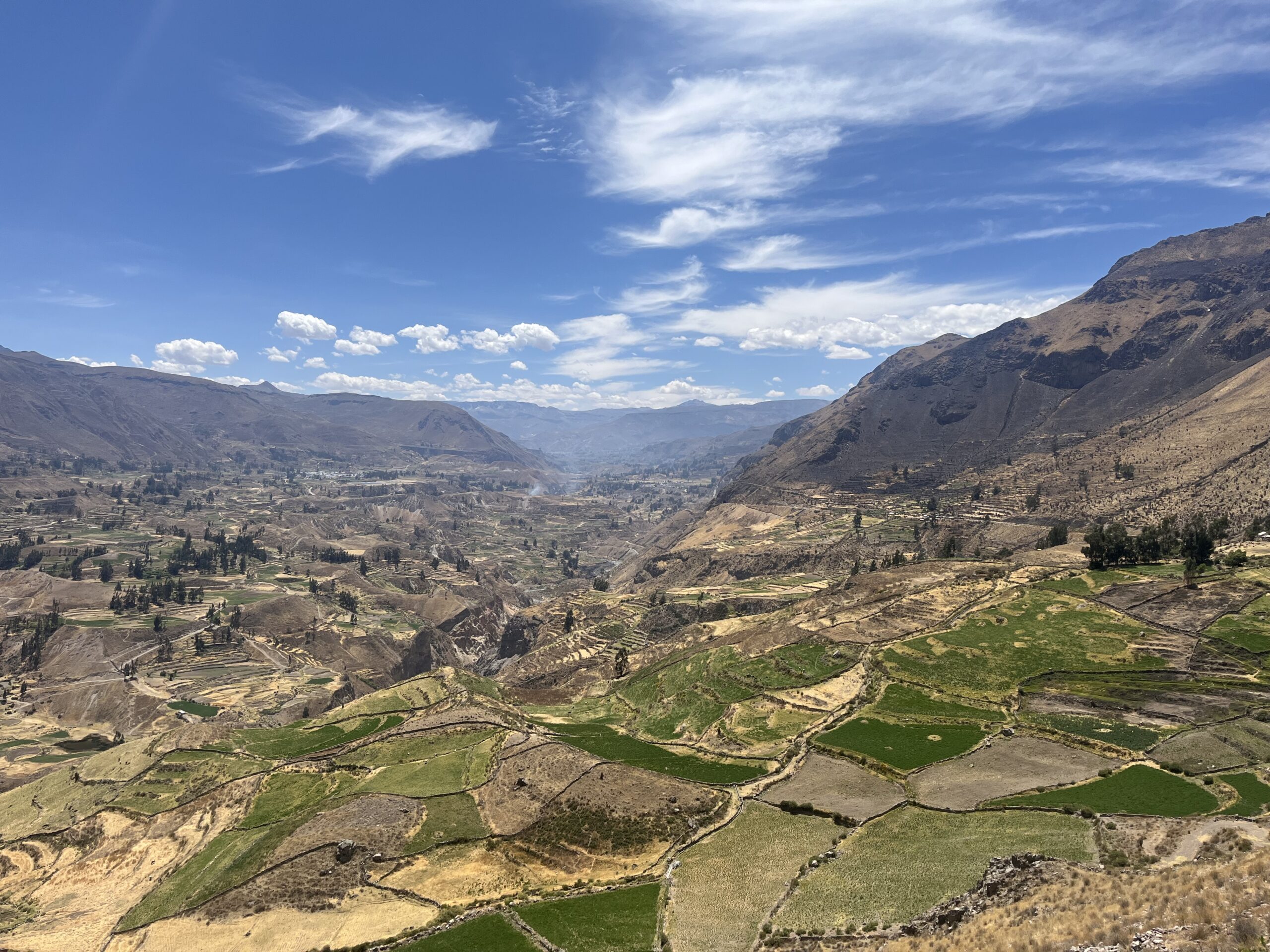
Sunday 3 November: Exploring the Majestic Colca Canyon
Today marked the beginning of our bikepacking adventure in Peru, taking us from the town of Cabanaconde to Chivay along the breathtaking Colca Canyon. The canyon views were truly magnificent, with condors soaring above us as we passed scenic viewpoints, or miradores.
The ride began with a steady uphill climb on paved roads, allowing us to ease into the day. However, the second part of the journey was a test of endurance as we navigated rugged gravel paths that rose and fell with the landscape. Thankfully, a tailwind gave us a welcome boost.
Although we’re still acclimating to the altitude, the day’s ride was relatively short, letting us finish off with a relaxing soak in the hot springs—a perfect way to recover and prepare for what lies ahead.
Day 2: Chivay -> Sibayo (41 km)
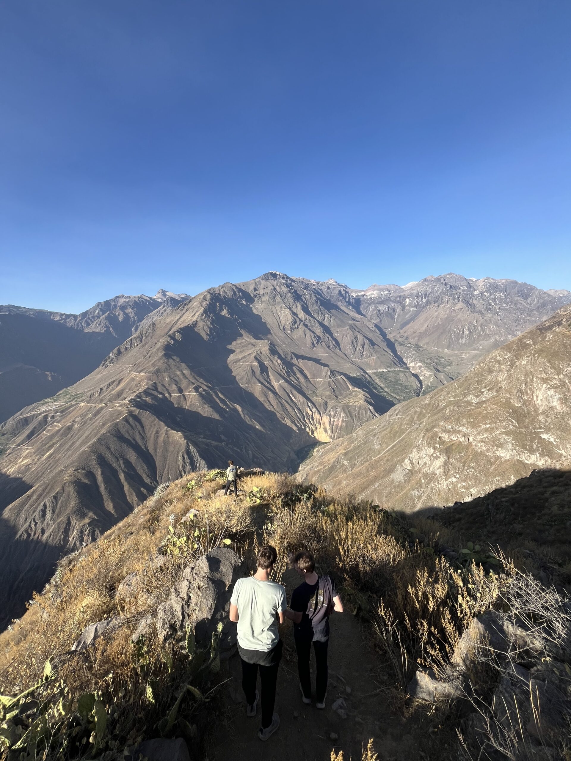
Monday 4 November: An Unforgettable Hike a Bike Through Colca Canyon
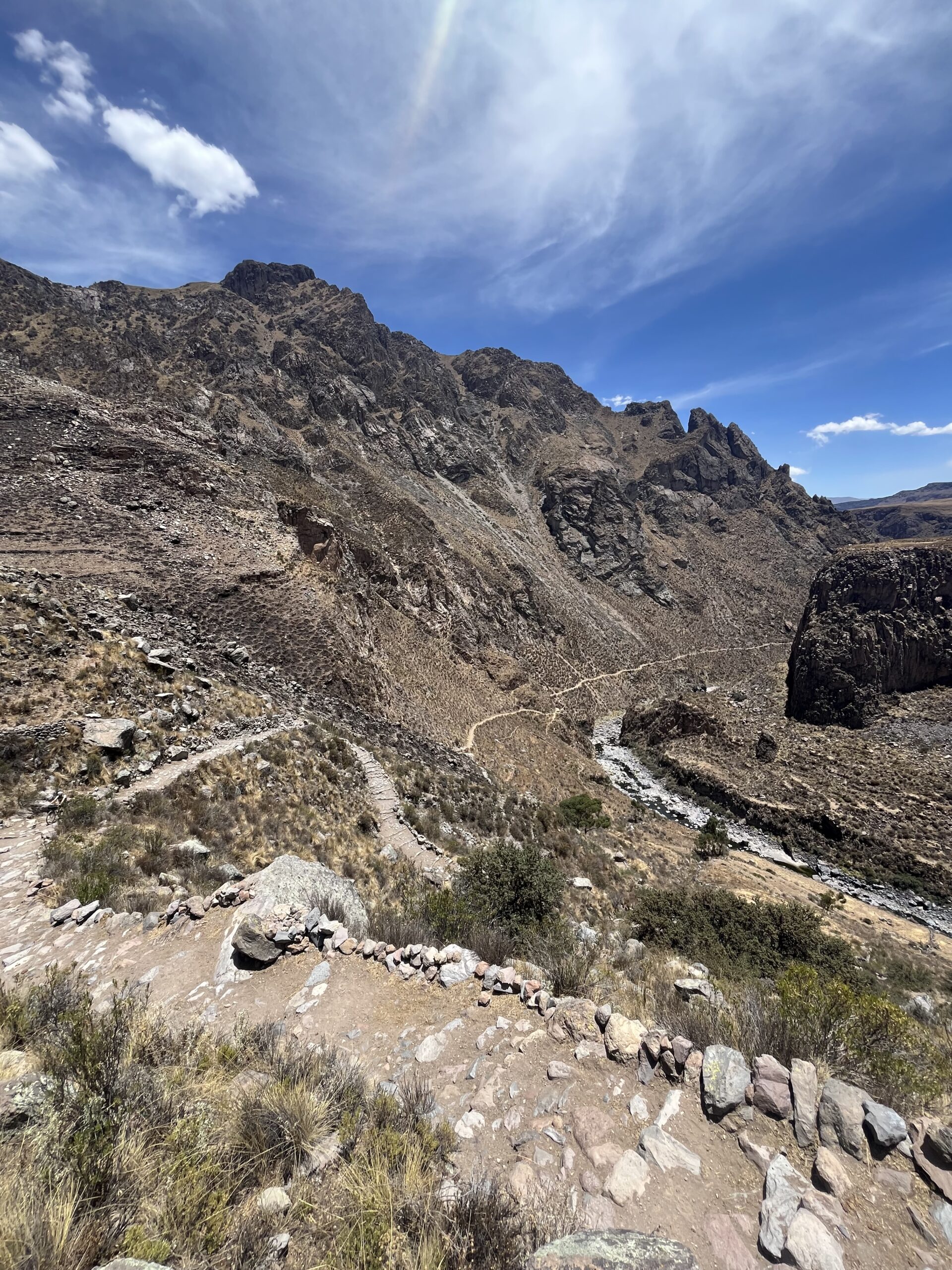
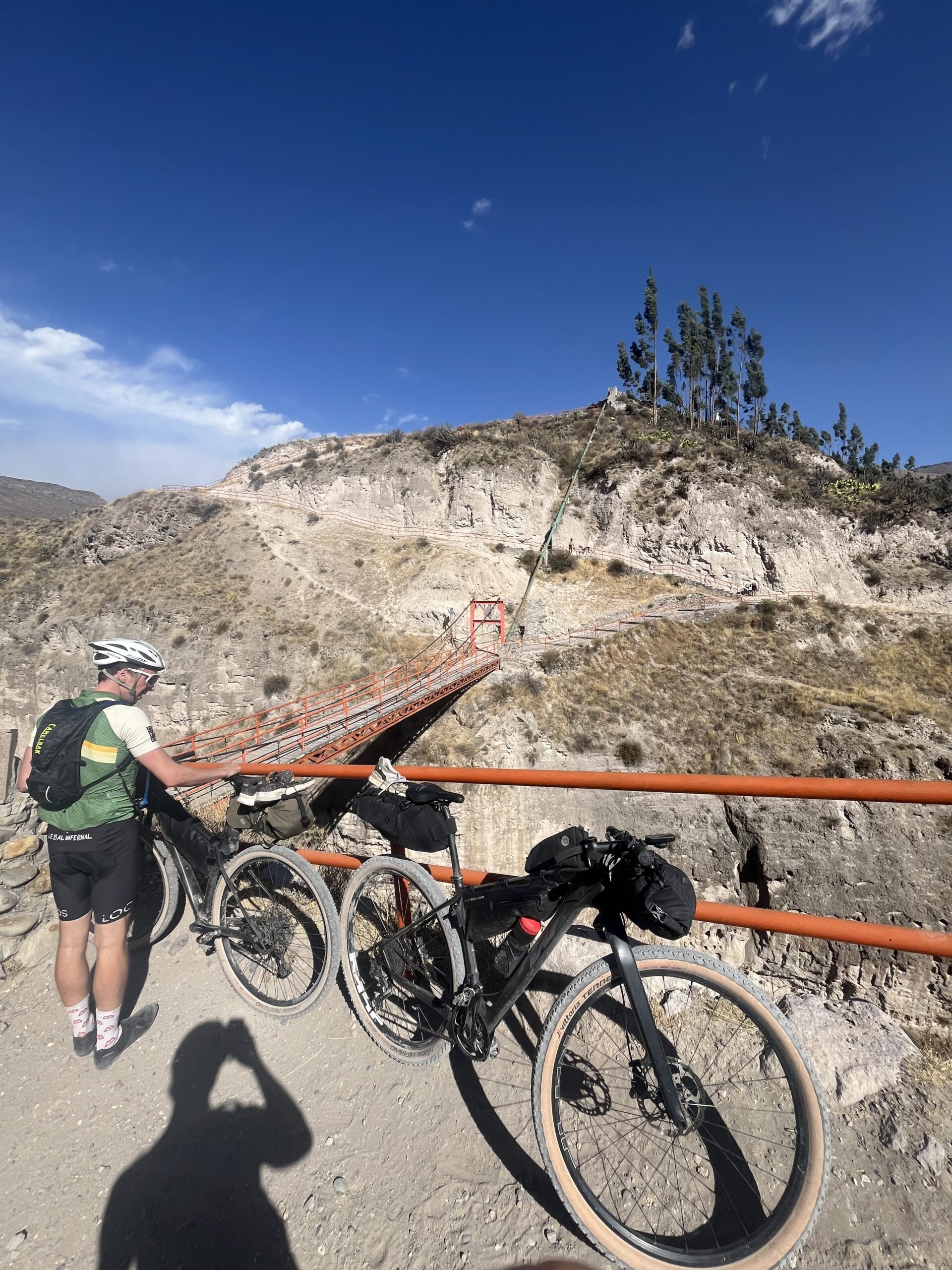
Today’s ride had an unexpected start when one of our bike brakes failed. Luckily, in Chivay, we stumbled upon a legendary bike shop, where a resourceful mechanic patched it up in a truly unconventional way. Brake fixed, we set off along a spectacular singletrack that wound its way through Colca Canyon. This route might just be one of the best we’ve ever ridden.
The last kilometer surprised us with a steep, stair-filled climb that turned into a hike-a-bike effort. But the top was worth it—the view was jjabsolutely breathtaking. We lingered, taking in the sweeping vistas of the canyon, making the most of this moment.
After a break, we rode to a nearby village for lunch, re-energized by the local flavors. The final kilometers were a thrilling descent into Siquani, framed by panoramic views of the canyon. Our day ended in the warm welcome of our Peruvian host, a perfect conclusion to a perfect ride.
Day 3: Sibayo -> Virginniyoc (81 km)
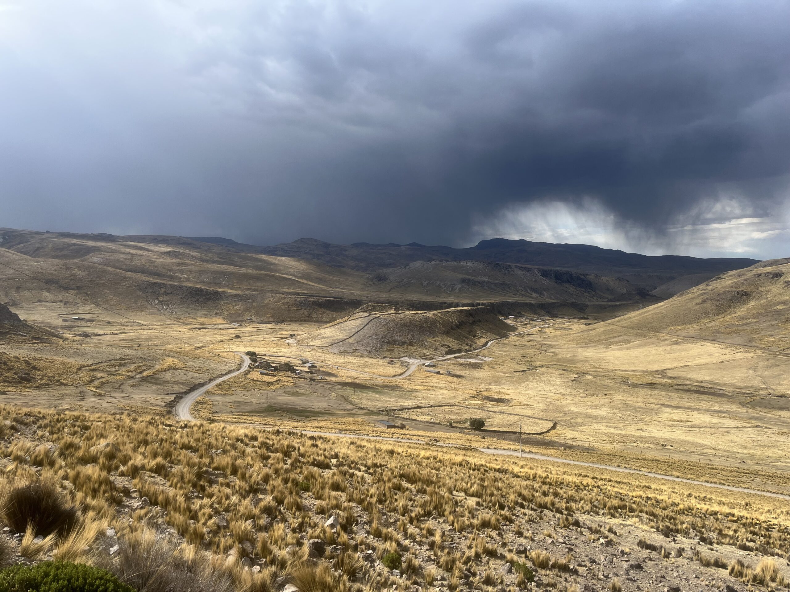
Tuesday 5 November: A Grueling Ascent from Sibayo to 4700m
Today’s ride began in Sibayo at an altitude of 3,800 meters, kicking off with a demanding 25-kilometer climb that took us up to a staggering 4,700 meters. Right from the start, we felt the effects of the altitude—heavy breathing and fatigue set in quickly. As we climbed higher, the slopes eased, but the sheer altitude led to headaches and lightheadedness for some of us. At the summit, we regrouped before a swift descent, rewarding ourselves with a much-needed break and a refreshing cola at a small shop.
The rest of the journey kept us above 4,000 meters, where the altitude continued to challenge us. Yet, the vast plateau was breathtaking, with quiet gravel paths stretching among herds of alpacas and llamas. The landscape’s solitude and beauty offered a sense of calm even as we pushed through the strain.
The final stretch was a rough climb to 4,500 meters, battling loose, rolling gravel that tested every ounce of our remaining strength. Reaching the top was an accomplishment, but it left us completely drained, each of us collapsing from our bikes in exhaustion. After a brief rest, we began the descent, grateful to leave the high altitude behind as we made our way to our evening stop. There, we were welcomed by a kind Peruvian woman, a warm end to a challenging and memorable day.
Day 4: Virginniyoc -> Espinar (43 km)
Wednesday 6 November: A Restful Day’s Ride to Espinar
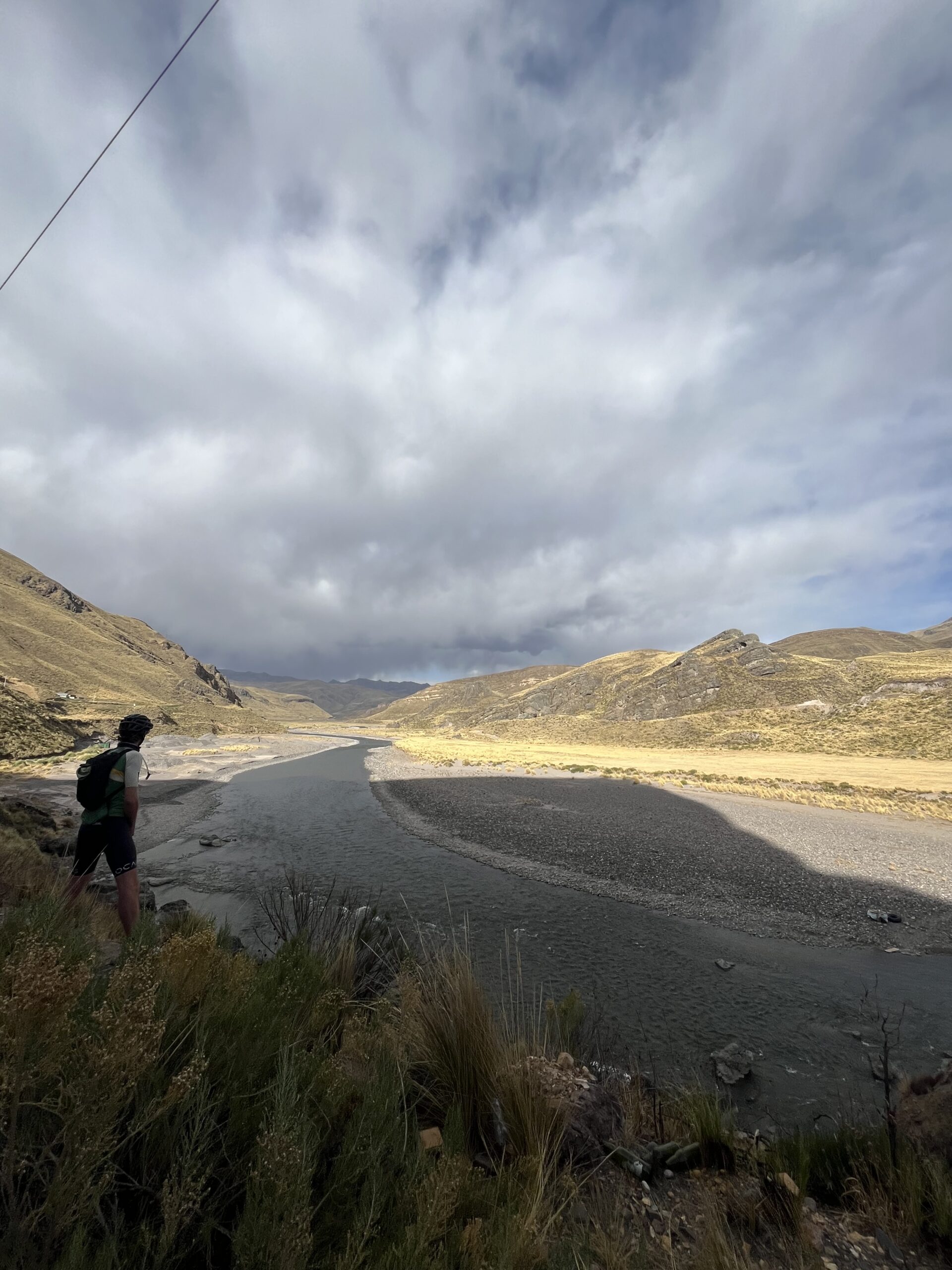
After yesterday’s grueling ascent, today was a well-deserved rest day. We began the morning slowly, enjoying a delicious breakfast and a relaxed walk along the river. Leaving the lodge, we set out along the canyon, riding downstream beside the river. The gentle descent made for easy riding, though the gravel surface led to a minor crash, leaving us with some torn pants and a few scrapes—thankfully nothing serious.
Pressing on, we eventually exited Tres Cañones and took a break with some coca leaves, which gave us a boost as we reached the open plains. The road improved as we approached Espinar, and the wide-open views and smooth surface made for a peaceful, leisurely ride. Arriving in Espinar, we found a hotel near the Plaza de Armas, ready to rest up for the next leg.
Day 5: Espinar -> Sicuani (84 km)
Thursday 7 November: Gravel Roads and Breathtaking Views
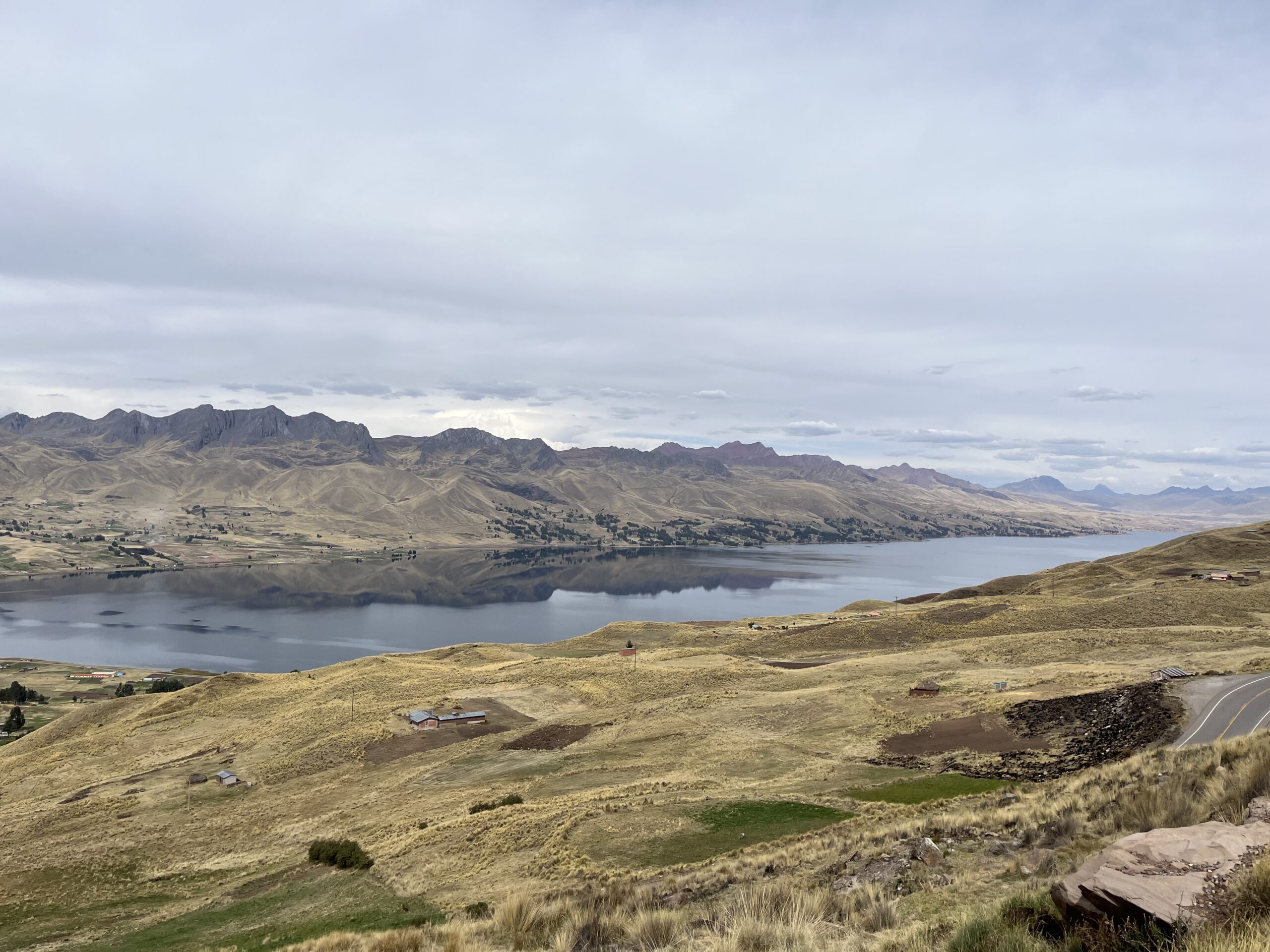
Leaving Espinar, we set off on a smooth gravel road that flowed with gentle climbs and descents. Compared to previous days, the surface was smooth, allowing us to cover kilometers effortlessly. Riding at an altitude around 4,000 meters, we felt far more adapted, and the team’s energy was high as we soaked in the expansive views, with towering mountains rising in the distance.
We stopped for lunch in the quiet village of El Descanso, the only settlement along the way. With renewed energy, we tackled a final 10-kilometer climb. The gradient was kind, and at the summit, we were rewarded with an incredible view over Laguna Langui. We paused to take it all in, feeling on top of the world.
The last 30 kilometers were a blissful descent through scenic mountains, each kilometer as enjoyable as the last. This was one of those unforgettable rides that reminds us why we love bikepacking in Peru.
Day 6: Sicuani -> Pitumarca (59 km)
Friday 8 November: Peru’s Valleys
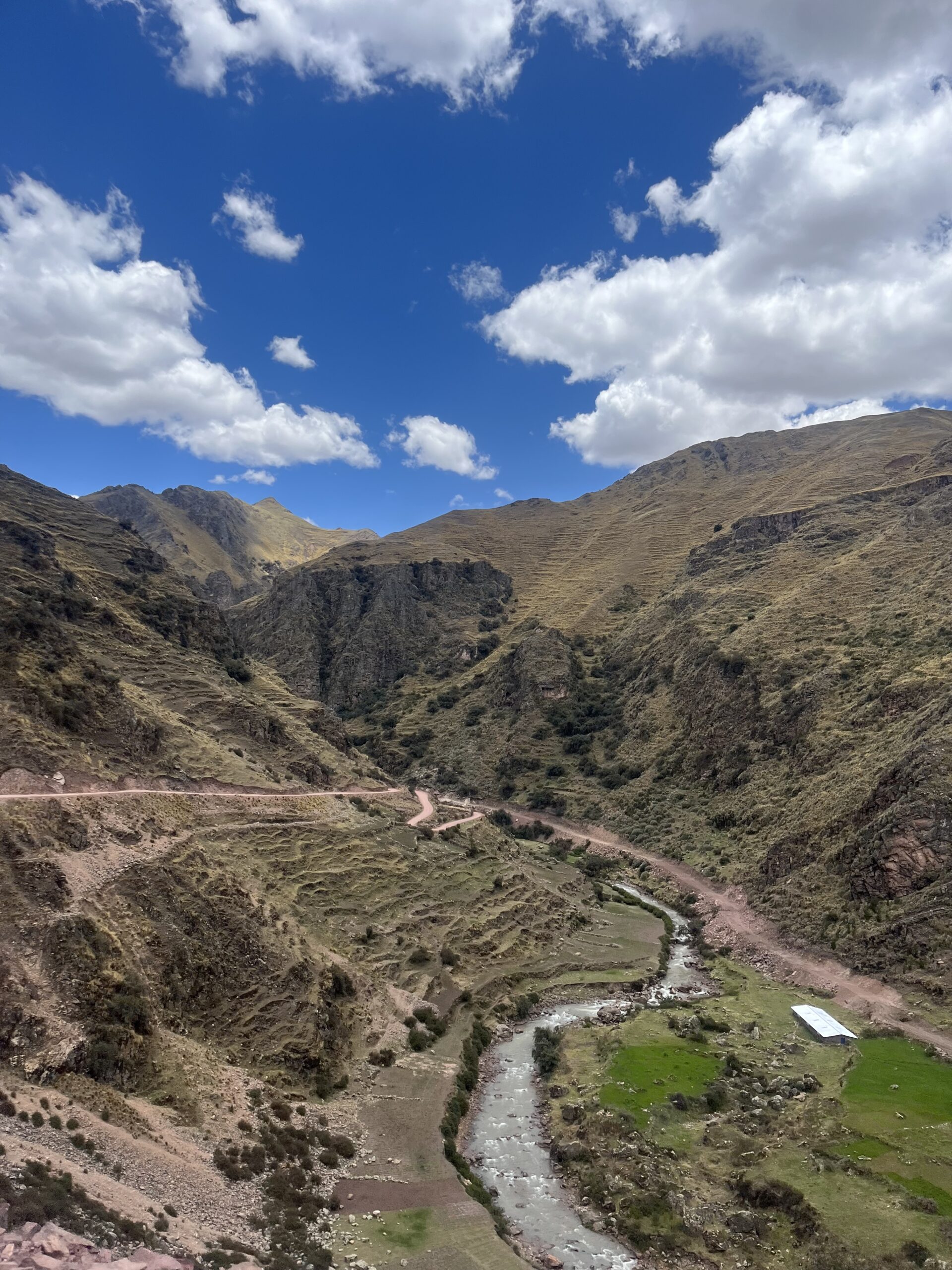
Our journey began in Sicuani, where we encountered a crowd of fellow travelers following the well-worn path from Puno to Cuzco. We took a busy road for the first few kilometers, heading in the same direction as most tourists. After a brief stint on the main road, we veered onto a parallel gravel track, finding a quieter route.
The road meandered through a peaceful valley, offering us undulating stretches on a relaxed, scenic gravel path. Passing through the village of Combapata, we rejoined the busier road until we reached Checacupe, where we took a detour into another secluded valley. This led us to Pitumarca, a small town buzzing with the excitement of a local festival.
After checking into our hostel, we enjoyed a hearty lunch and set down our bags. Energized, we hopped back on our bikes to visit Machu Pitumarka, a fascinating ancient archaeological site nearby. As the day wound down, we returned to Pitumarca to rest, ready for the big climb ahead to Rainbow Mountain.
Day 7: Pitumarca -> Cusipata (69 km)
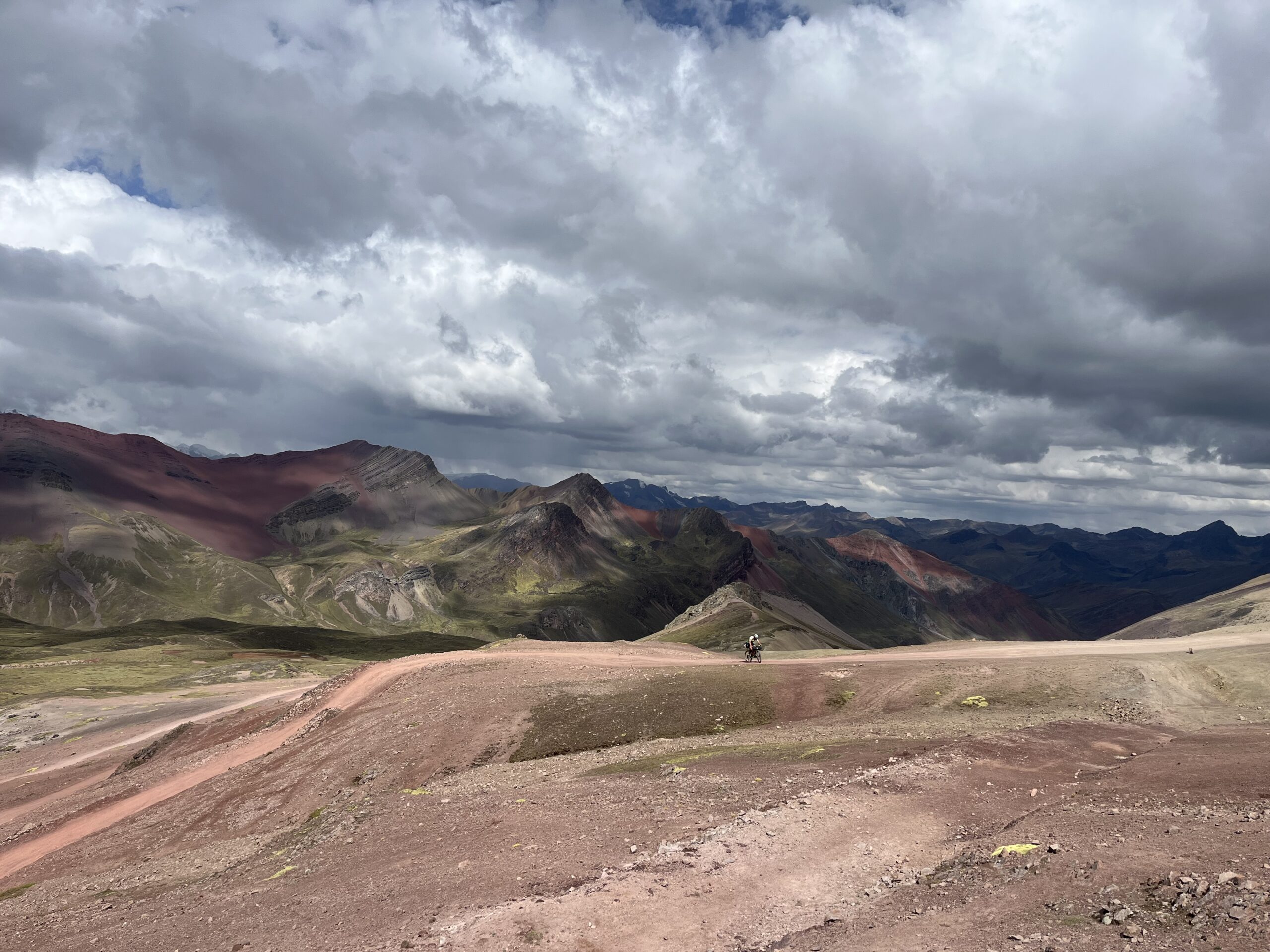
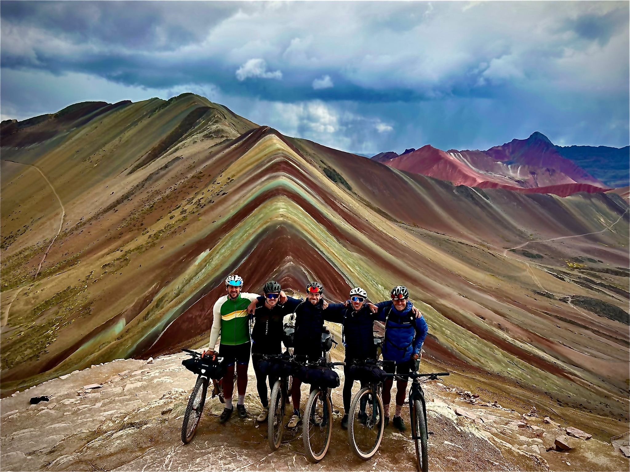
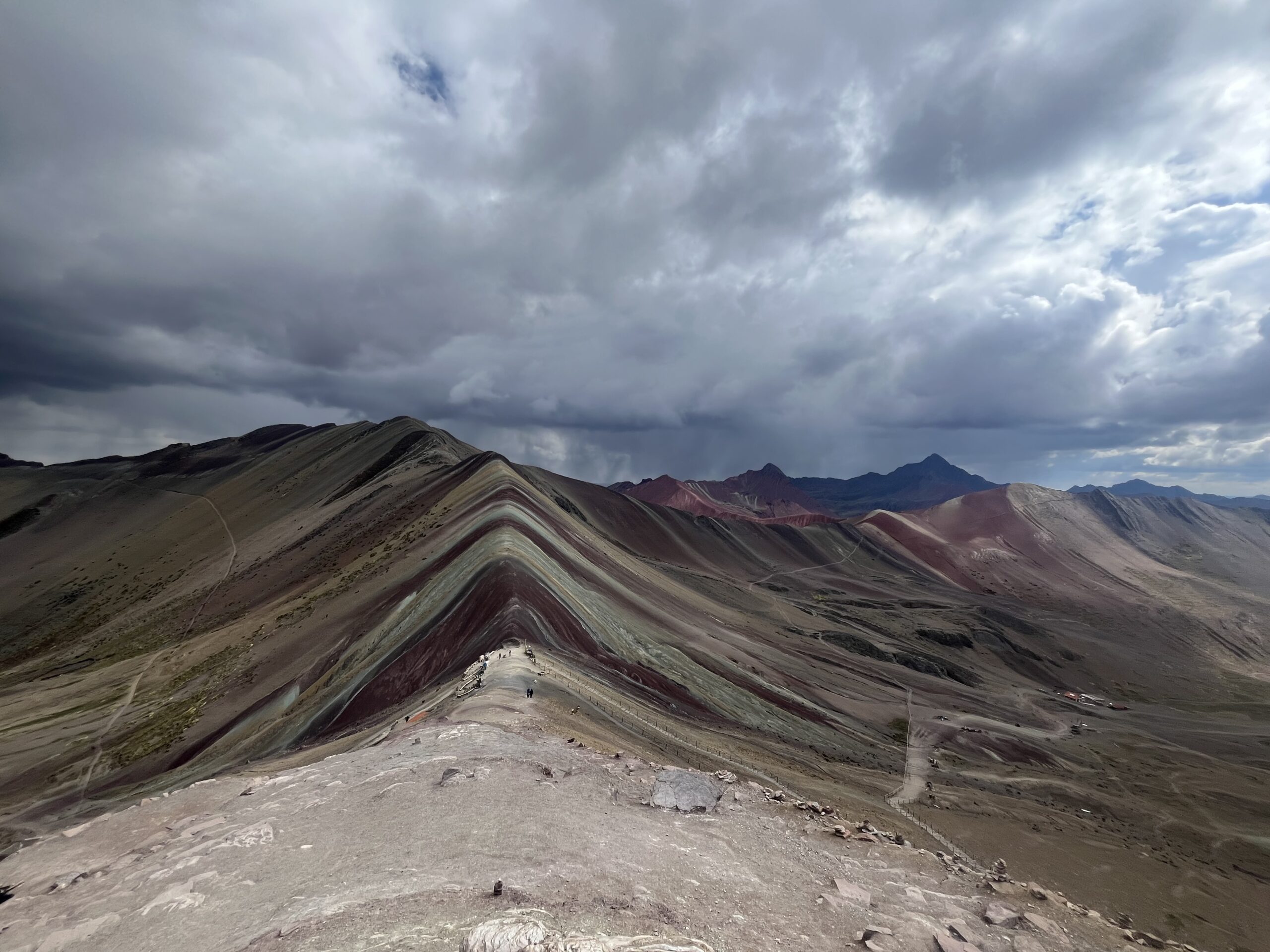
Saturday 9 November: An Epic Ascent to Peru’s Rainbow Mountain
Today promised to test us to the limit: a formidable 40-kilometer climb to the summit of Rainbow Mountain, reaching over 5,000 meters. After a light breakfast, we set off. The climb began gently, winding through scenic stretches as we steadily gained altitude. But 25 kilometers in, we felt the toll of an insufficient breakfast, and the only relief along the road was a small shop where we fueled up with some cola.
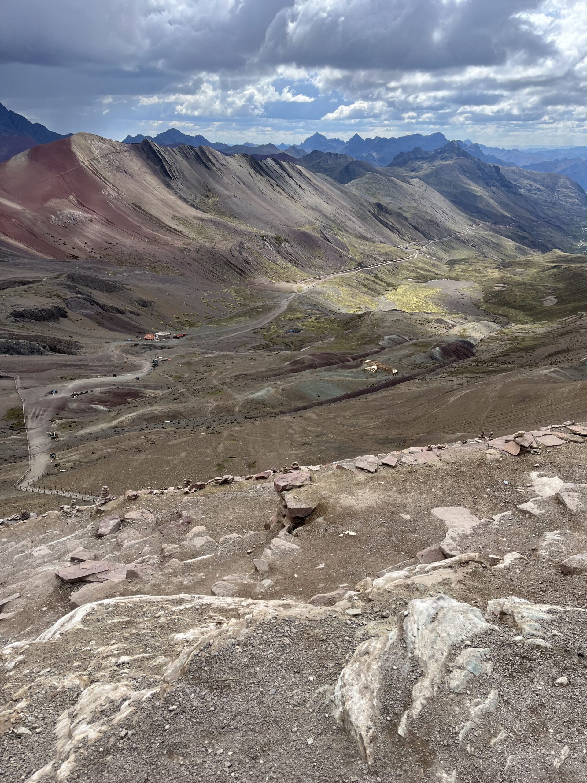
As we pressed on, the incline grew steeper and the landscape shifted dramatically. The Red Valley unfolded before us, vibrant and otherworldly. Nearing the entrance to Rainbow Mountain, we had just 5 kilometers left to the summit, but at 4,500 meters and with limited food, every pedal became a struggle. With gradients consistently above 10%, we each found our own pace, inching forward meter by meter. Reaching the top felt monumental—exhausted and emotional, laughter gave way to tears.
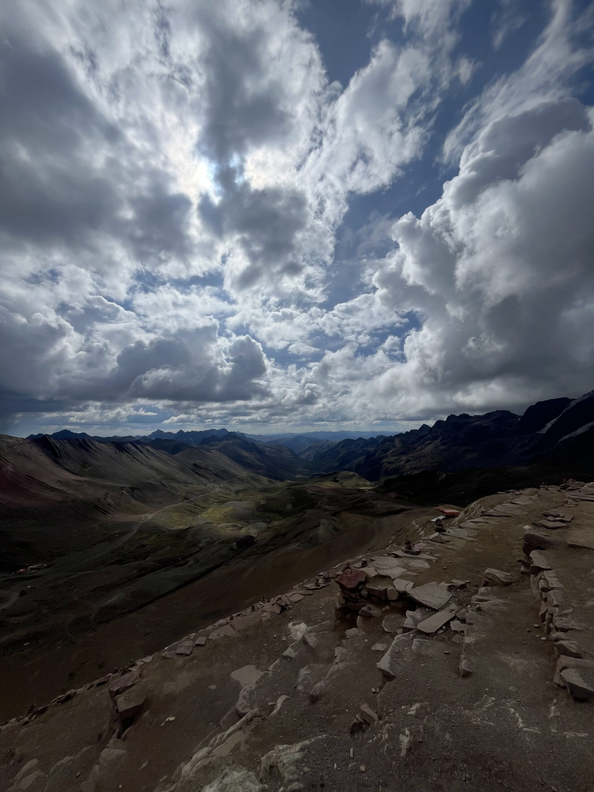
After a brief rest, we could finally take in the view. This was one of the most breathtaking vistas we’d ever seen: the rainbow-colored slopes stretched across both valleys, snow-capped peaks punctuating the horizon. And the best part—we had it almost entirely to ourselves, capturing photos and savoring the moment.
The descent that followed was equally unforgettable: a smooth, sweeping 30-kilometer ride with panoramic views all the way down. We relished every minute, the day’s effort melting into pure exhilaration as we reached civilization and found our lodge. It was one of the hardest days on the bike—but absolutely worth it for a view like this.
Day 8: Cusipata -> Pisac (83 km)
Sunday 10 November: Gliding Through Valleys
Compared to yesterday’s grueling ascent, today’s ride was a breeze. Though the distance was longer, the route trended downhill, allowing us to relax and enjoy the journey. We took the main road, riding in a head-over-head formation for the first 35 kilometers until we reached Urcos. There, we stumbled upon our first panadería and indulged in delicious empanadas—much-needed fuel for the ride ahead.
Back on the road, we followed the paved highway, which grew quieter after we branched away from the Cusco route. Winding through serene valleys, we continued taking turns at the front, making good time. Eventually, we arrived in Pisac, where the sudden presence of tourists was a stark contrast to the quiet of previous days. The day’s ride, with its smooth descents and scenic views, was the perfect recovery after the challenge of Rainbow Mountain.
Day 9: Pisac -> Ollantaytambo (72 km)
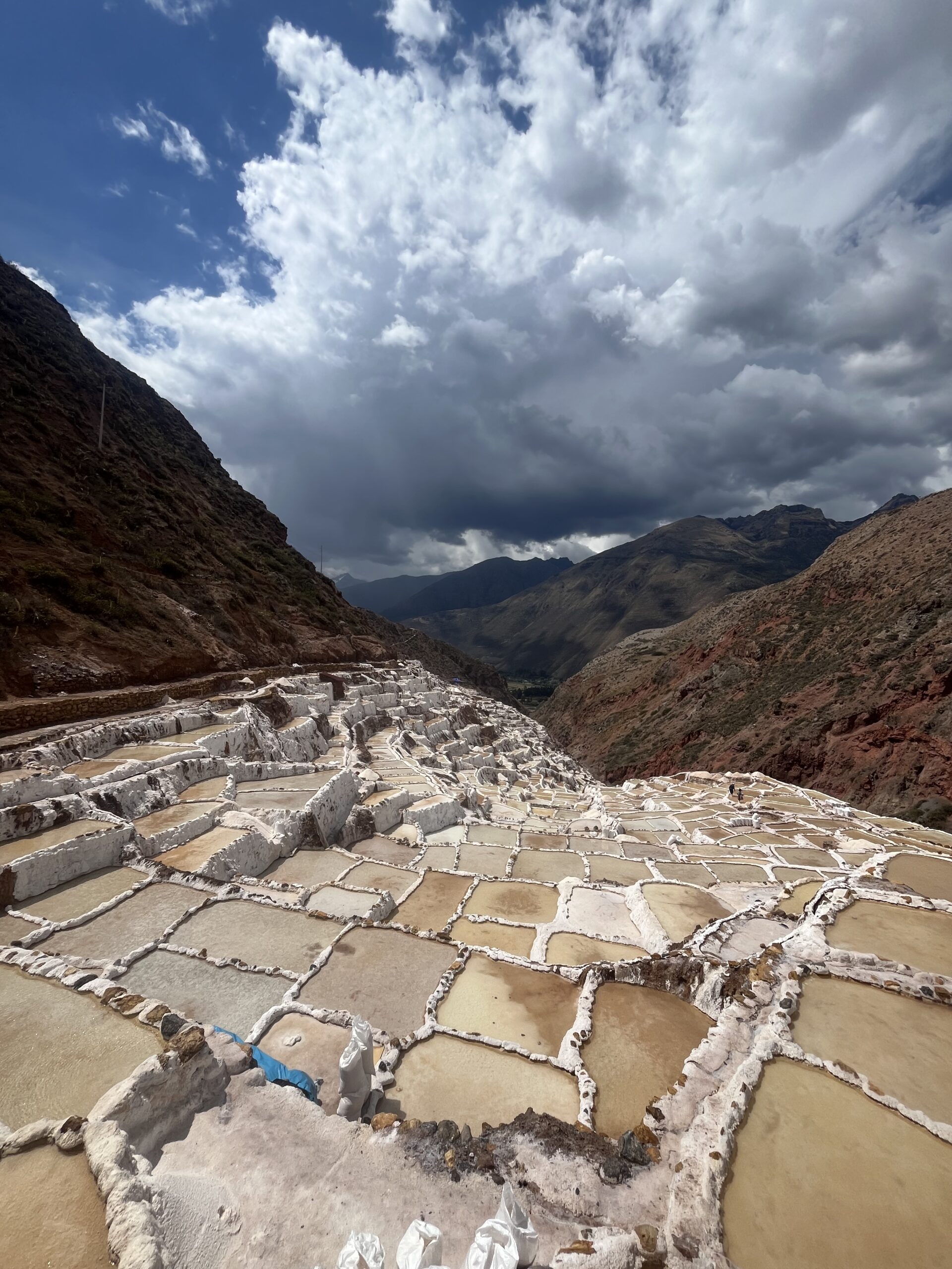
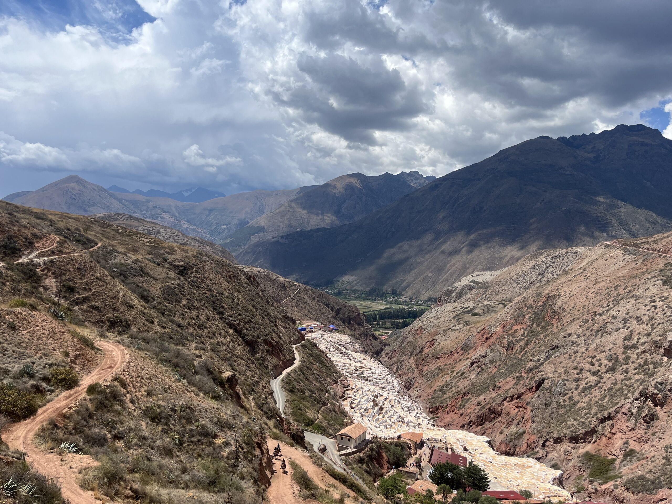
Monday 11 November: A Ride Through the Sacred Valley and Maras Salt Mines
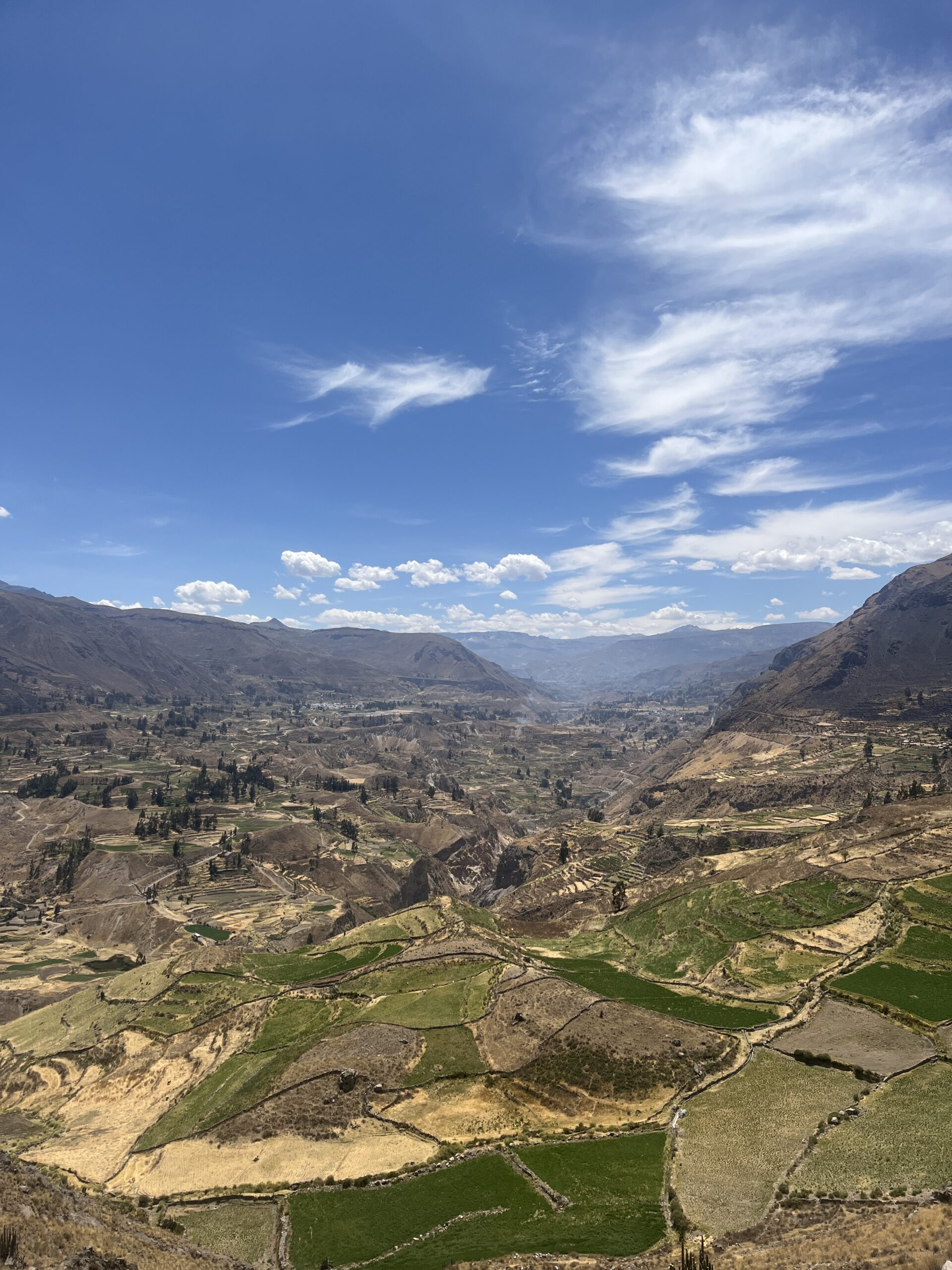
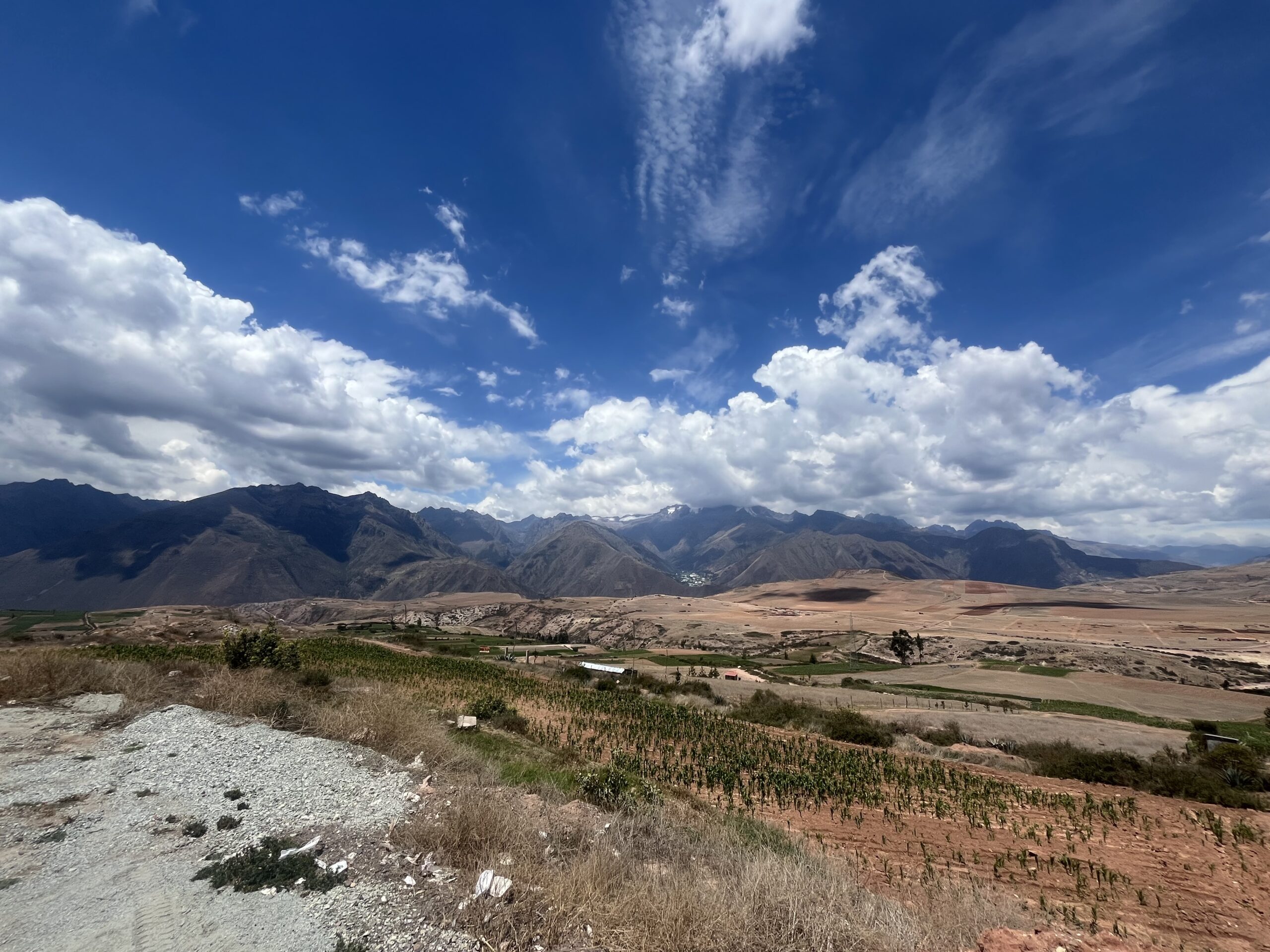
Our ride began in Pisac, taking the main road through the Sacred Valley. We made a quick stop at a local bakery to refuel and then enjoyed a gentle, relaxing 40 km stretch of slightly downhill, paved road. The peaceful atmosphere made for easy conversations as we rolled along.
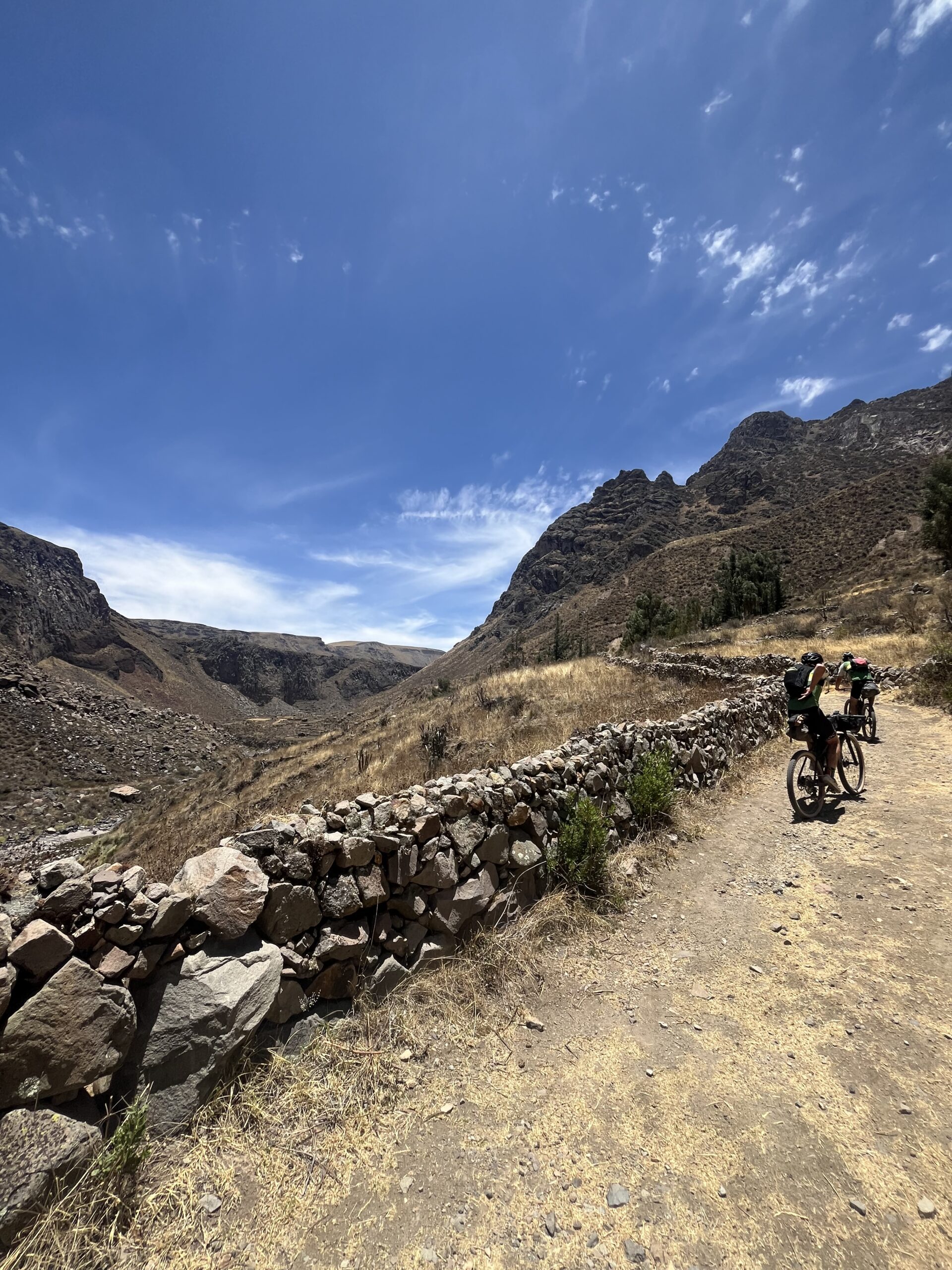
After 40 km, we left the main road and began a 15 km climb out of the valley. The gradient wasn’t too steep, and we reached the top quickly, arriving in Maras. Leaving the paved road behind, we transitioned to a thrilling singletrack descent that rewarded us with breathtaking views over the Salinas de Maras—an ancient network of terraced salt ponds still harvested today. We took time to explore the salt mines, picking up some locally harvested salt as a souvenir.
From there, we continued down the singletrack until we rejoined the main road. With just 10 km of flat terrain left, we made our way toward our final destination. The last stretch into Ollantaytambo led us over rough cobblestones but treated us to stunning views of the ancient archaeological site—a perfect end to an unforgettable day.
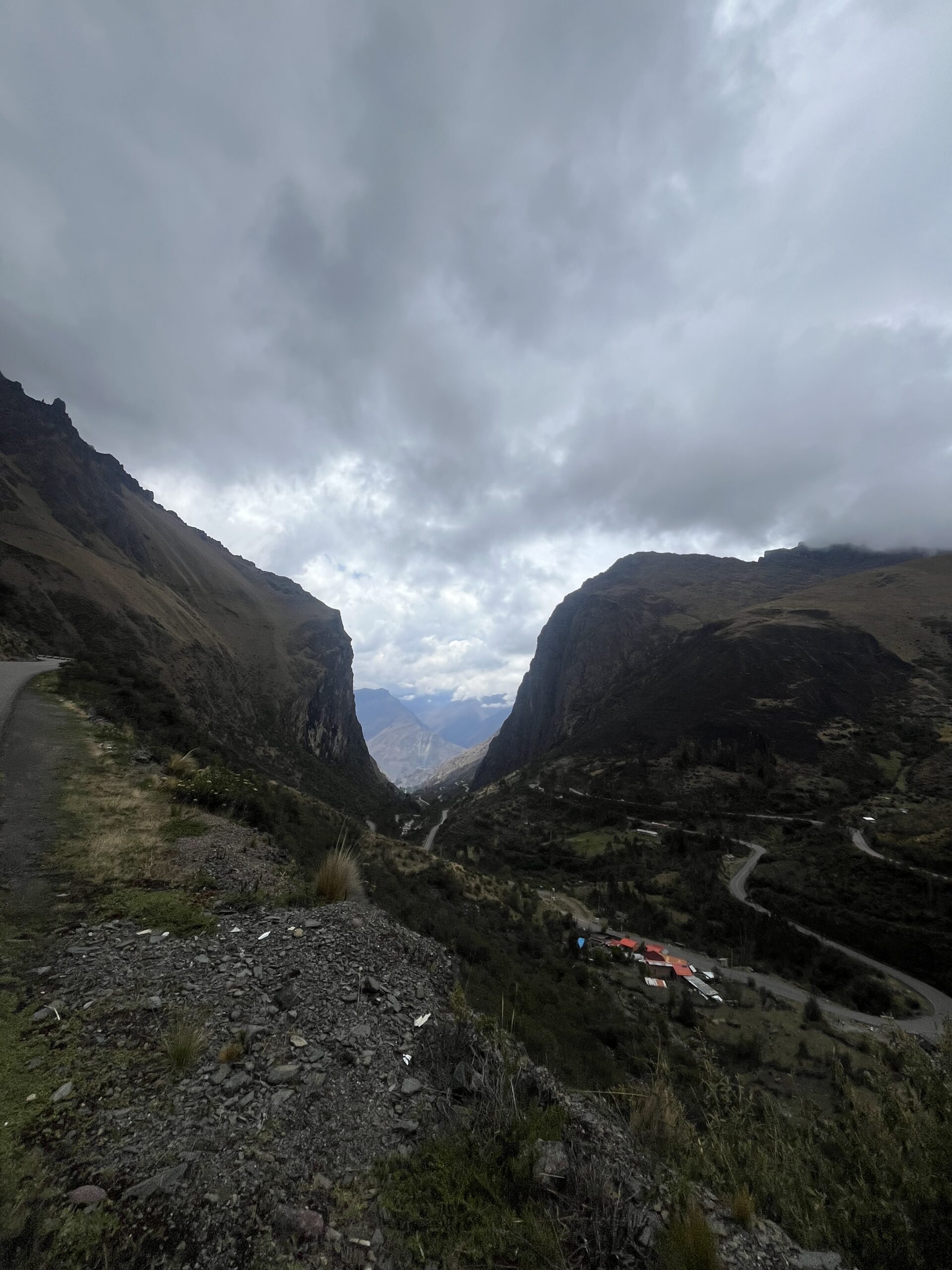
Day 10: Ollantaytambo -> Huayopata (105 km)
Tuesday 12 November: Into the Clouds, Conquering Ollantaytambo’s Green Ascent and Dream Descent
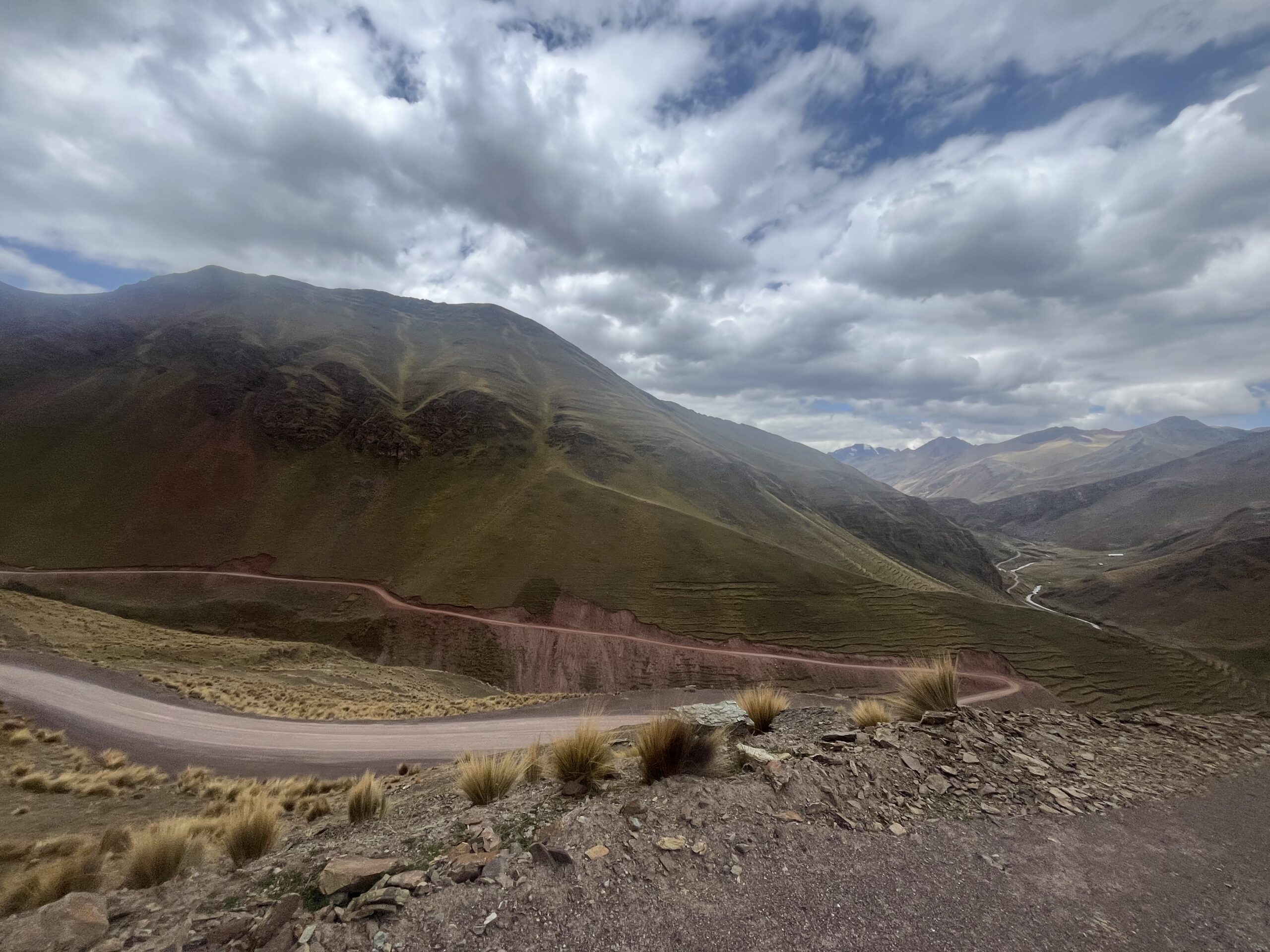
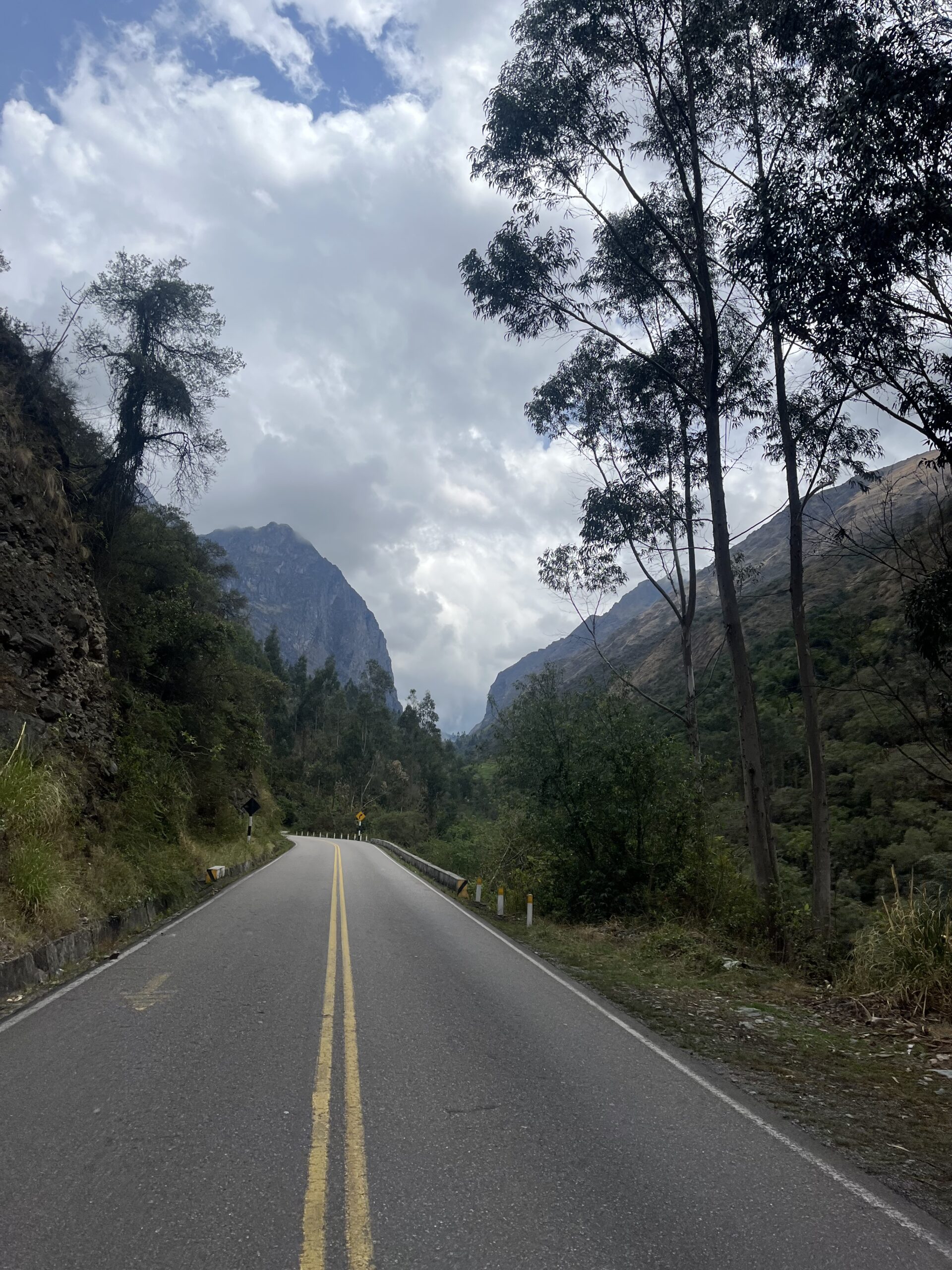
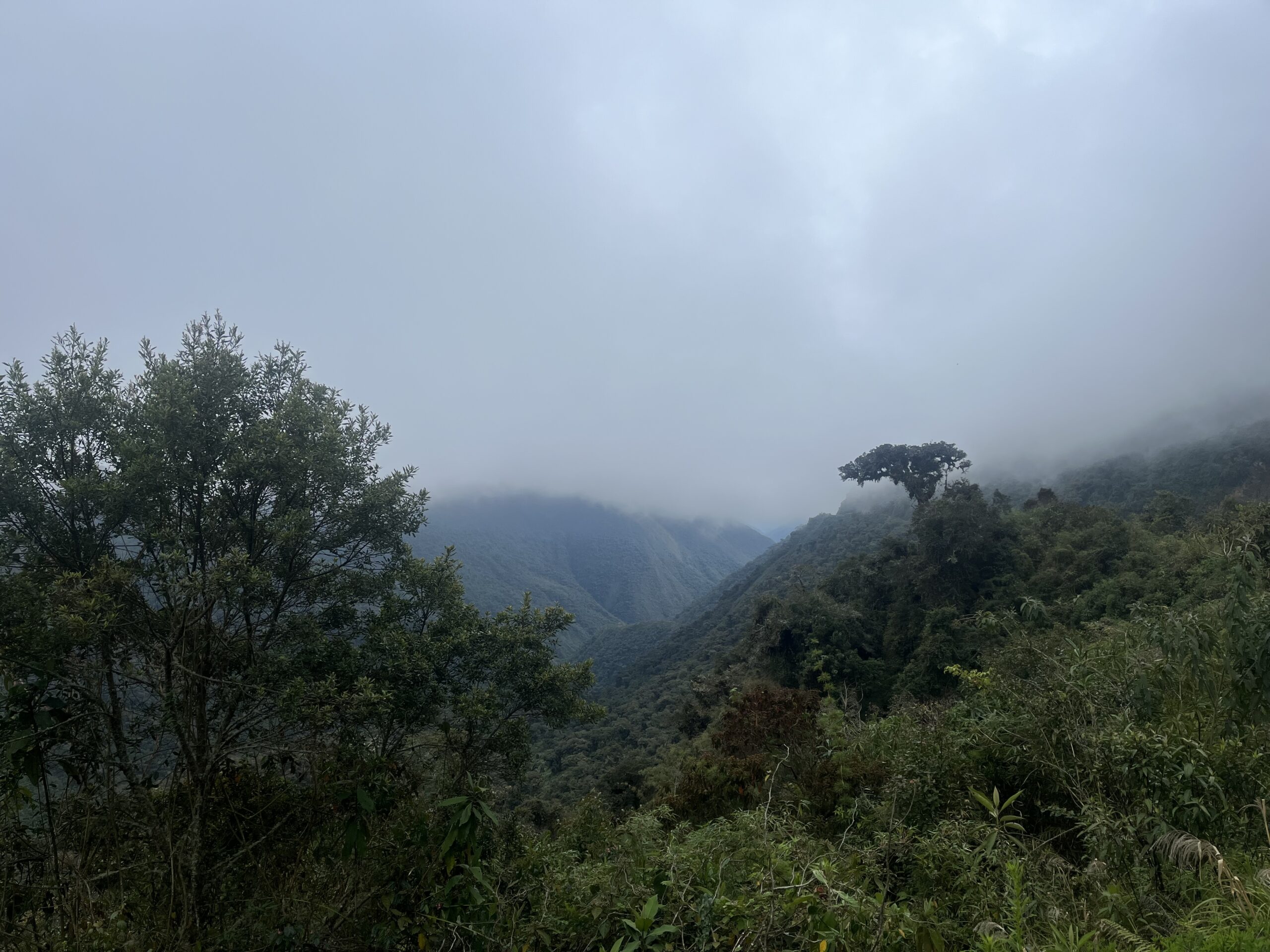
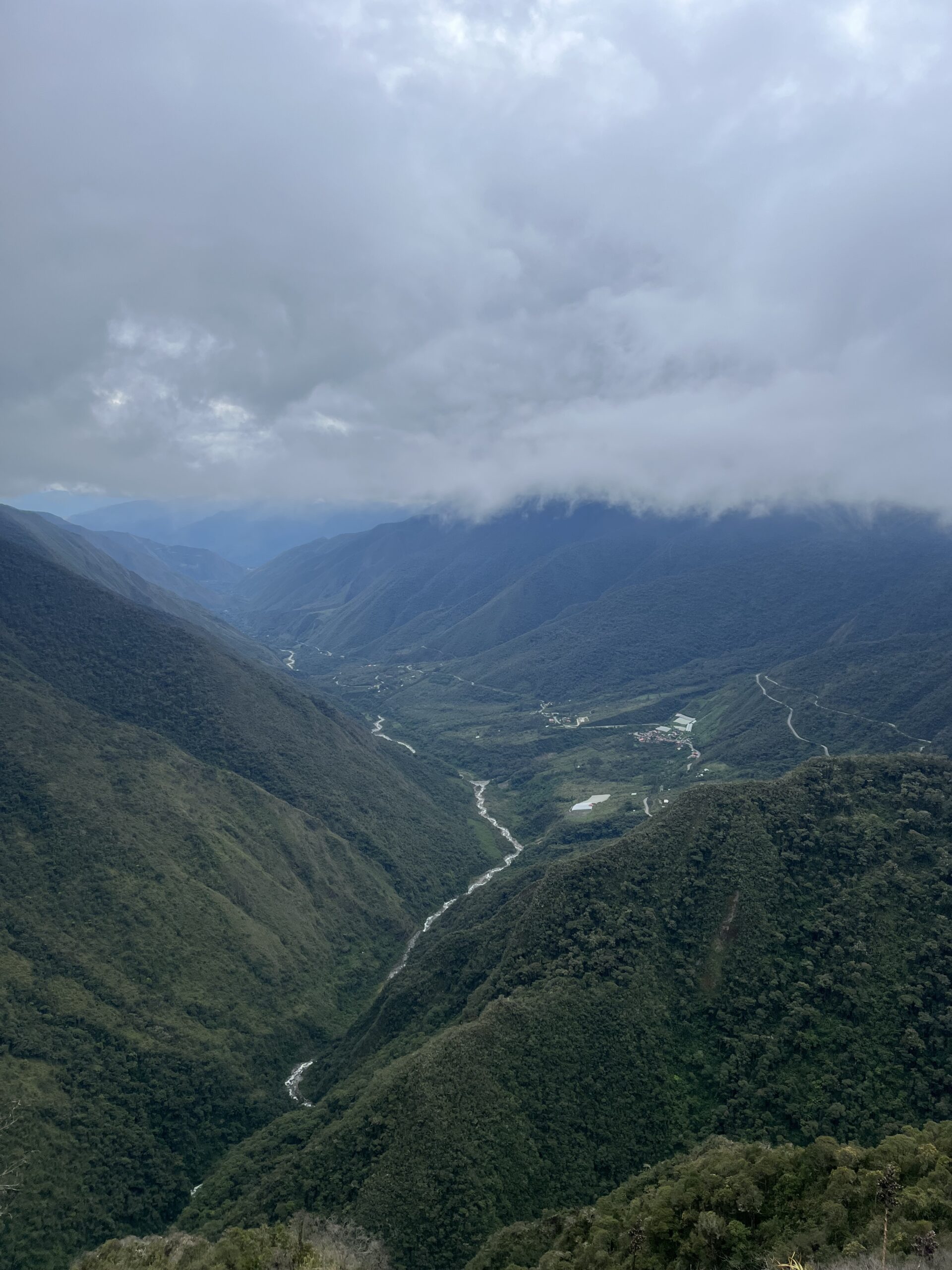
After a hearty breakfast, we left Ollantaytambo’s bustling main road, veering away from the crowds to begin a scenic 40 km climb. Riding through a winding canyon, we found the grades gentle, easing us into a steady rhythm around countless switchbacks. As we gained altitude, the landscape turned lush and green, reminding us of Yosemite’s beauty.
With every meter, the skies grew grayer, and soon, we were climbing through clouds, barely noticing as we reached the summit. A few layers later, we began our descent—visibility low, anticipation high. And just a few kilometers down, the valley opened up before us, unveiling the cloud forest’s dense greens and tangled vines. For a solid 60 km, we coasted through an incredible flowy downhill, weaving past fruit trees and lianas. It was easily one of the best descents we’ve experienced—a thrilling reward for a memorable climb.
A day like this, filled with the perfect mix of challenge and reward, sets the bar high. Today might just be the peak of our cycling adventures.
Day 11: Huayopata -> Aguas Calientes (57 km)
Wednesday 13 November: Adventurous Ride to Aguas Calientes
After a rainy night, we set out early to reach Aguas Calientes in time to buy our tickets for Machu Picchu. Around 6 a.m., we started our journey with a few kilometers of downhill through the lush, green forest. We wound our way down to the base of the final climb, knowing we had 40 kilometers uphill to reach our goal.
The climb was unpredictable, and the rain had turned the gravel into thick, heavy mud. We pushed hard through the first 15 kilometers, then were briefly rewarded with a short descent. Suddenly, the road was blocked by a truck, and we quickly saw why it had stopped—huge rocks were tumbling down the mountainside.
In a rush of adrenaline, we tried to climb past the truck with our bikes as stones pelted down around us. Some of the rocks hit a bike frame, causing two fractures, but thankfully, no one was injured. With duct tape as a temporary fix, we managed to press on.
Ten kilometers from Aguas Calientes, the road disappeared, leaving only a narrow train track through dense forest. We carefully followed the track, squeezing along sections where passing would be difficult if a train came. Finally, we arrived in Aguas Calientes, greeted by cheering tourists eager to hear about our journey. What an incredible adventure!
Day 12: Aguas Calientes-> Santa Teresa (17 km)
Thursday 14 November: Macchu Pichu
To visit Machu Picchu, there are two main options: take a bus or hike to the entrance. Naturally, we chose the active route, opting for a one-hour hike up to the iconic site. Upon reaching the bustling entrance, we joined the steady stream of visitors making their way through the awe-inspiring ancient city.
The ruins themselves were breathtaking, but the surrounding landscapes added another layer of magic to the experience. After exploring the site, we descended back into the valley and decided to leave the crowded town behind. A short journey along the train tracks brought us to Santa Teresa, where we settled in for the night, ready for more adventures ahead.
Day 13: Puacartambo -> Pillcopata (106 km)
Saturday 16 November: An Technical Descent into Manu National Park
After a rest day and a taxi ride from Santa Teresa via Cusco to Paucartambo, our journey continued. Arriving in Paucartambo late in the afternoon, we still had some distance to cover, so we set a steady pace. The landscape shifted to a rocky terrain, dotted with occasional trees. Before long, the road began to climb, becoming steeper with each turn. As we ascended, the scenery transformed into lush greenery, signaling the approach of the cloud-covered highlands.
A few kilometers from the summit, we hit a snag—a puncture. After a quick repair, we reached the misty and desolate peak, marking the entrance to Manu National Park. The ticket office was already closed. From there, the real adventure began: a dramatic descent from 3,500 meters to approximately 1,000 meters over 80 kilometers of winding roads.
The initial stretch of the descent was thrilling, with stunning views all around. However, our bikes, already bearing the toll of the journey, revealed their weaknesses—our brakes were far from reliable. As the descent turned more technical, the sky darkened, and the rain began. What started as a drizzle quickly escalated into a torrential downpour, drenching everything in sight.
Navigating the slippery roads with failing brakes became increasingly challenging. A small crash served as a stark reminder of the risks, prompting us to slow down and accept that we’d be soaked regardless. For the next hour, we battled the rain, the waterlogged road, and our weary bikes.
When we finally reached our destination, drenched but relieved, we made our way to the local market for a well-deserved meal. The day had tested our limits, but it also gifted us with unforgettable moments of raw adventure.
Day 14: Pillcopata-> Villa Salvacion (26 km)
Sunday 17 November: A Tranquil Day in the Jungle
Our day unfolded at a relaxed pace as we cycled deeper into the heart of the jungle, surrounded by breathtaking views and incredible wildlife. Along the way, we spotted macaws, toucans, monkeys, and even a tapir.
The winding forest trails invited us to savor every moment, soaking in the serenity of this lush paradise. Eventually, we reached a small village, where we dropped off our bikes at our lodging and set off to explore further.
On foot and by raft, we ventured into the surrounding jungle, discovering the stunning Machuhuassy Lagoon. Its tranquil beauty left us in awe, a perfect reflection of the calm and wonder that defined the day.
Day 15: Villa Salvacion -> Shintuya (39 km)
Monday 18 November: Racing through the jungle
The day began early and at full speed, racing through the jungle trails to reach Shintuya on time. Awaiting us were our local guides, Los Tres Hermanos, ready to take us deeper into the jungle by boat.
The ride was a thrilling mix of climbs and exhilarating descents through the dense forest, with the scenery flying by. Before we knew it, we arrived, eager to kick off a day packed with adventure: soaking in hot springs, swimming in natural pools, and fishing in the heart of the jungle. The perfect reward for an unforgettable morning on the move.
Day 16: Shintuya -> Villa Pillcopata (58 km)
Tuesday 19 November: The Final Ride: Farewell to the Rainforest
Our last day on the bike took us back along the same road toward the edge of the rainforest. Every pedal stroke was full of memories, as we soaked in the sights and sounds of the jungle one final time. A light rain accompanied us on and off, adding to the mystique of the journey.
The rainforest continued to surprise us with its beauty, making this final stretch feel calm and fulfilling. As we rolled into Pillcopata, where our transport awaited, we grabbed some snacks for the ride and reflected on an incredible adventure.
This marked the end of a wonderful and exhausting bikepacking trip—an experience full of challenges, beauty, and memories we’ll cherish forever. Now, it’s time to head to the coast for a few days of well-earned relaxation before flying back home.
Leave a Reply